Richland County believes in transparacy and cooperation with the public. For this reason, we have elected to allow the public free and open access to our GIS data layers. We attempt to make this as easy as possible for users while still protecting the integrity of our network. Below you will find instruction to download GIS data layers using file transfer protocol (FTP).
There are other methods to use ftp, but we have found the most success when users download using a free ftp client like filezilla. It is easily found by going to the following site: https://filezilla-project.org/download.php?type=client
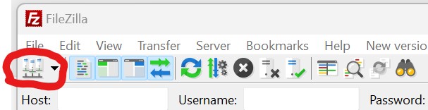
Once you have downloaded the filezilla program, you should create a new shortcut to our site by clicking on the “site manager” icon in the upper left hand of the window, just below the word “file” in the menu.
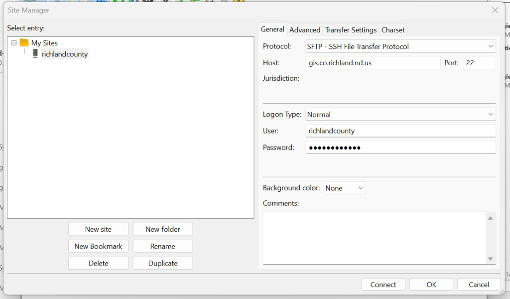
In the site manager window, click on the button to create a “new site” and then put the following information into the “general” tab. Use Host: gis.co.richland.nd.us, port: 22, and Protocol: SFTP. The user is richlandcounty and pw is GISdata2024!
These are the only required settings, so then you can select the site in the left window, and then click on the “connect” button. If you see this prompt, it is normal:
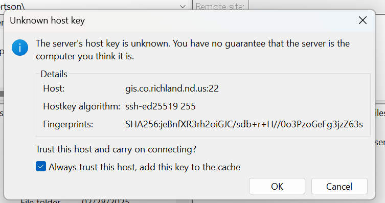
Select “Always trust this host…” If you configured it correctly, it will then show you a directory list in the right hand side of the screen with multiple folders, one for each category of GIS layer. Double click the directory with the data you require, and then select the data layers, and then right click to choose either download or add to que. If you choose to create a que, then to process the que, use ctrl+P to start your download. The files will be downloaded to the folder selected in the left hand pane (which will have a directory of your local computer). It is best to set that up prior to starting the download.
***Disclaimer***
This data has been created as a public service. Every effort has been made to offer the most current, correct, and clearly expressed information possible, however inadvertent errors can occur. Therefore, this information should not replace any official information source. Richland county makes no warranty, representation or guaranty as to the content, accuracy, timeliness or completeness of any of the information provided herein. Richland County GIS shall assume no liability for any errors, omissions, or inaccuracies in the information provided regardless of how caused; or any decision made or action taken or not taken by reader in reliance upon any information or data furnished hereunder.
If you believe any portion of this map to be incorrect, please help us make the corrections by providing documents of proof to:
David Reid
Richland County GIS Technician
418 2nd Ave N
Wahpeton, ND 58075
gistech@co.richland.nd.us